A hidden gem, suddenly off-limits
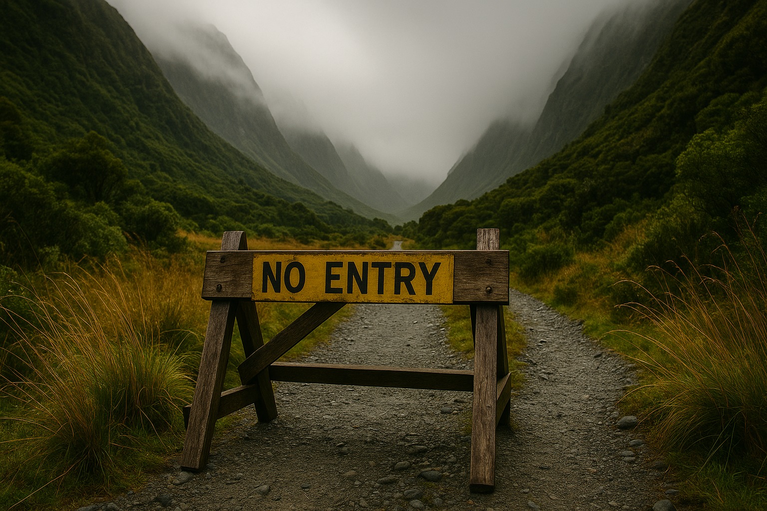
In the shadow of the Southern Alps, a once-beloved backcountry route has become quietly restricted. The Arahura Valley track, long prized by experienced trampers, now turns visitors back beyond a nondescript trail notice. The change arrived with little fanfare, just a bland sign and a phrase about safety concerns.
For years, this path drew hikers through beech forest, over icy glacial rivers, and into a hushed alpine basin. The reward was solitude, waterfalls, and that distinct West Coast stillness. Now, a small notice says the section is closed due to land stability and “cultural assessments,” with no reopening date.
The official explanation — and what’s missing
DOC’s public line stresses “land movement” and collaboration with iwi over “culturally sensitive sites.” On the face of it, that sounds straightforward. But regulars insist the terrain is no more treacherous than other South Island tracks that remain open.
As one longtime tramper put it, “We’ve walked this valley for decades, and it’s held up better than places plastered in slip warnings.” That skepticism points to a gap between the words on the sign and the full story. The idea of rūnanga-led cultural assessments suggests the issue might be as much about protection as about erosion.
Sacred ground, uneasy whispers
In local circles, the word “wāhi tapu” surfaces with regularity. Hikers talk about sacred places that were never mapped for public use, and which may have been disturbed unintentionally. Some recall rumors from early 2024: a small group stumbled upon what looked like a burial site or unearthed a possible taonga near the headwaters.
DOC won’t confirm the details, which:
“may be necessary,” says a cultural advisor, “to keep curiosity from becoming harm.” That silence can be both a shield and a spark for speculation.
What we know — and what we don’t
- The upper Arahura section is closed due to cited stability risks and cultural reviews.
- DOC is in discussions with local iwi regarding management and access.
- There is no timeline for reopening, only “until further notice.”
- The exact nature of any cultural find or site remains undisclosed.
- Locals are split between demands for transparency and calls for respect.
A community caught in the middle
For some West Coasters, the closure feels like a curtain drawn across a place they consider part of their backyard. Guides worry about lost bookings, hut wardens about dwindling traffic, and towns about another pinch to fragile tourism. Others argue that safeguarding iwi values is non-negotiable, especially if the area contains burials or ancestral treasures.
A Ngāi Tahu elder summed it up starkly: “If it’s sacred, it isn’t a backdrop for selfies.” That conviction carries its own gravity, especially in a country still learning to balance public access with enduring kaitiakitanga.
Safety, geology, and the climate wildcard
Even if culture is the core, geology is rarely a bit-player. The Arahura is shaped by fast water, steep slopes, and restless rainfall. One truly bad winter can loosen bluffs, undercut roots, and turn benign creeks into braided hazards. Climate extremes make yesterday’s “safe line” today’s risk.
If the land is moving and the valley is sensitive, DOC is obliged to pause and plan. The question is whether the “temporary” label masks a longer transition toward new rules, seasonal restrictions, or guided-only access.
What DOC isn’t saying — and why it matters
The missing detail isn’t just the “what,” it’s the why-now. If the trigger was a recent discovery, DOC likely faces a tangle of legal, cultural, and ethical responsibilities. Public disclosure might endanger a site, invite looting, or set off well-meaning but harmful attention. Yet opacity breeds mistrust, especially in communities asked to shoulder the costs.
The agency could maintain cultural privacy while offering clearer process: outline decision stages, set review milestones, and explain the criteria that would allow partial reopening. When expectations are visible, uncertainty becomes more bearable.
A path forward that honors both values
The valley doesn’t need to become a flashpoint. It needs a patient mix of science and tikanga-led care. That could include time-bound closures during assessment, signage that explains general principles without revealing sensitive locations, and co-designed access plans that put iwi in the driver’s seat.
A collaborative approach might convert conflict into stewardship. It could also model how other backcountry places navigate overlapping histories and modern demand.
The line at the trailhead
For now, the sign stands, and the upper valley remains quiet. The forest keeps its secrets, and the river keeps its pace. Somewhere behind the closure lies a story that is both ordinary—land that shifts, communities that debate—and deeply extraordinary, a place where ancestors may rest and need guarding.
“Temporary,” the notice says, and perhaps it will be. But until the process is transparent and the reasons are clear, the Arahura will be more than a closed track; it will be a test of how a country honors both its wildness and its memory.