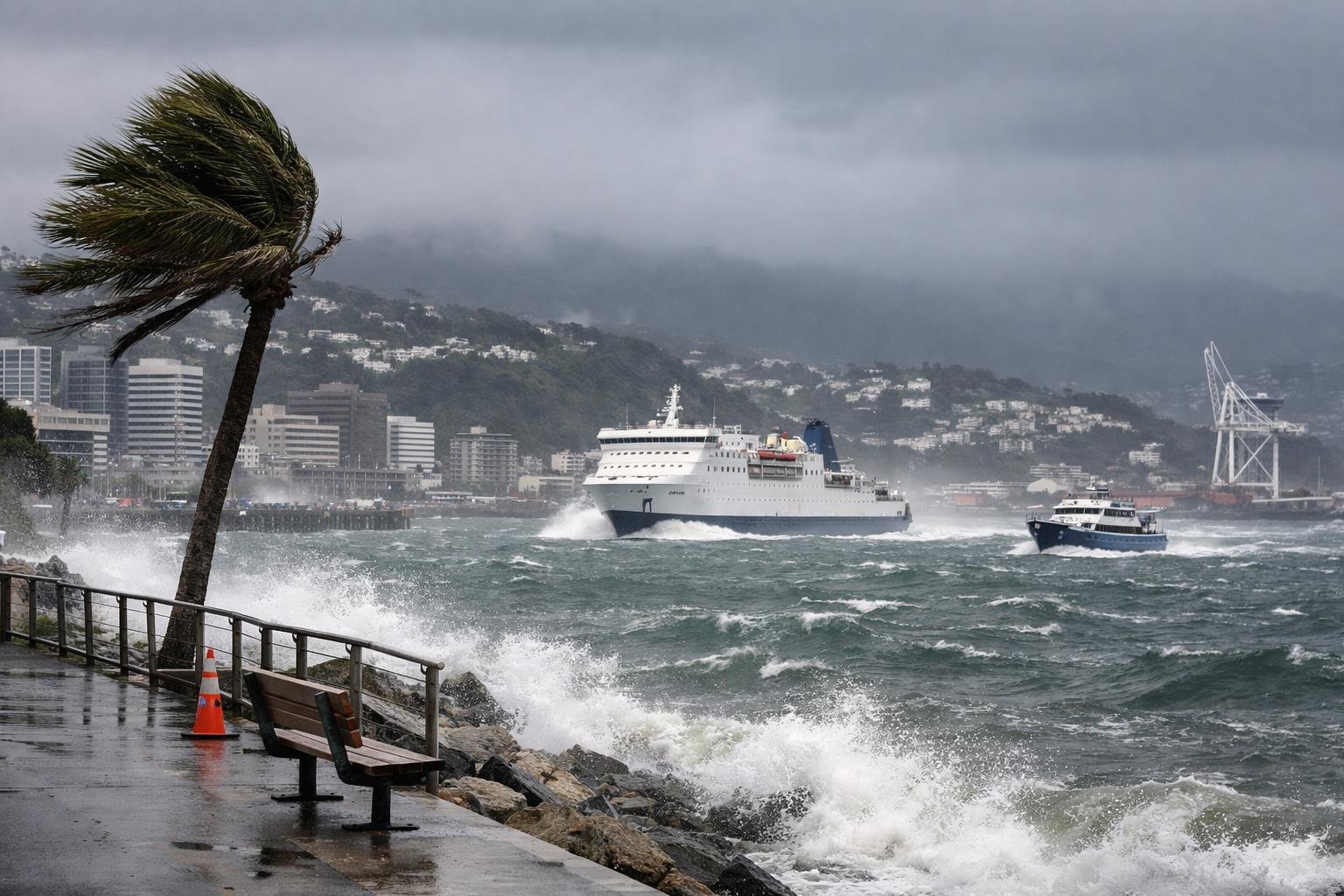
Wellington is bracing for a burst of damaging wind this weekend, the kind that rattles windows, topples bins, and churns up Cook Strait. Here’s how to plan smart, minimise stress, and travel safely while the gusts roar.
What the forecast means
Expect a vigorous northwest to swing southerly as the system passes, with peak gusts in exposed places likely to reach the 110–130 km/h range. “Expect short, sharp disruptions” as squalls move through, with the strongest winds near hilltops, harbours, and coastal suburbs.
Brief heavy showers may ride the front. The wind is the headline risk, but saturated ground raises the chance of fallen trees, surface flooding, and local power cuts.
“Secure it, or expect to lose it.” Trampolines, scaffolding sheeting, and loose roofing materials are common casualties in setups like this.
Timing and wind directions
- Saturday: Wind building through the afternoon, strongest overnight.
- Sunday: Still blustery early, easing later as the system tracks east.
Wellington’s topography accelerates flow: the Cook Strait gap supercharges gusts along the south coast and through the CBD’s wind tunnels. The Hutt Valley gets turbulent crosswinds; hill roads and saddle routes feel the fiercest surges. If you must drive, anticipate buffeting on exposed bridges and ridgelines.
Ferry disruptions: what to expect
Cook Strait is one of the most wind-exposed stretches of water in the country. Large short-period swells, heavy spray, and crosswinds can force schedule changes. Both operators typically adjust sailings in high-end gale conditions; vehicle loading can slow, and foot-passenger safety rules may tighten.
If you’re sensitive to motion, this is a tough crossing. “Book smart; travel light,” and keep medications handy.
Table: Expected operator responses during strong gales (subject to live updates)
| Aspect | Interislander | Bluebridge |
|---|---|---|
| Likely status at peak | Delays; selected cancellations possible in strongest gust/swell windows | Similar approach; targeted cancellations most likely overnight |
| Rebooking | Generally allows free rebooking when weather-disrupted | Comparable flexibility during weather events |
| Vehicles | May restrict high-sided vehicles, caravans during worst periods | May apply similar restrictions; loading can be paused |
| Check-in advice | Arrive early; watch texts/app/email for rolling updates | Arrive early; monitor website and SMS alerts |
| Seasickness | Large ship, but expect heavy motion; carry meds | Smaller profile can mean punchier ride; prepare accordingly |
| Contacts | Website status page, app, call centre, social feeds | Website status page, SMS, call centre, social feeds |
Always verify before you travel. Conditions can improve or deteriorate within an hour.
How to prepare at home and on the road
- Tie down or stow: bins, furniture, BBQs, trampolines, tools.
- Park away from big trees and loose scaffolding; fold wing mirrors.
- Charge phones and power banks; have a torch ready.
- Keep a small go-bag: water, snacks, warm layer, meds, copies of bookings.
- If driving, expect strong crosswinds; slow down, both hands on the wheel.
- For essential trips, allow extra time and keep fuel above half.
- Photograph your property now for any later insurance needs.
For boaties and waterfront businesses
Shelter up and double-check moorings. Don’t attempt a strait crossing during peak winds or strong opposing swells; harbour entries can be treacherous with rebound waves. Secure loose fenders, sails, and covers. On the waterfront, bring flags and signage indoors; latch doors and roller shutters. “If in doubt, don’t go out.”
Flights and public transport
Wellington Airport is prone to crosswind limits. Expect potential holding, diversions, or cancellations, especially during peak gusts. Travel with soft schedules, and keep carry-on lean in case of quick changes.
On land, wind-felled trees can disrupt rail lines and arterial bus routes. Check for rail replacements and delays, and watch for temporary road closures near slips or downed lines.
Travelling with kids, pets, or elderly passengers
Make comfort central. Pack spare layers, hydration, simple snacks, and motion-sickness remedies. For pets, secure carriers and bring absorbent pads in case the crossing gets rough or your ferry is delayed. If you’re supporting an older relative, build in rest points and have a clear backup plan should services pause.
Where to get reliable updates
- Weather and warnings: MetService official pages and app.
- Roads: Waka Kotahi NZTA traffic map, motorway signs, and regional social feeds.
- Ferries: Interislander and Bluebridge websites, text alerts, and customer lines.
- Airport: Wellington Airport arrivals/departures board and airline apps.
- Local transport: Metlink for rail/bus status.
Enable push alerts. Keep one eye on the radar and another on operator advisories. A little prep now will save you hours when the wind begins to howl.
